×

Loading...
Ad by
  • 推荐 OXIO 加拿大高速网络,最低月费仅$40. 使用推荐码 RCR37MB 可获得一个月的免费服务
Ad by
  • 推荐 OXIO 加拿大高速网络,最低月费仅$40. 使用推荐码 RCR37MB 可获得一个月的免费服务

13 Top-Rated Tourist Attractions in the Northwest Territories

1. Nahanni National Park Reserve
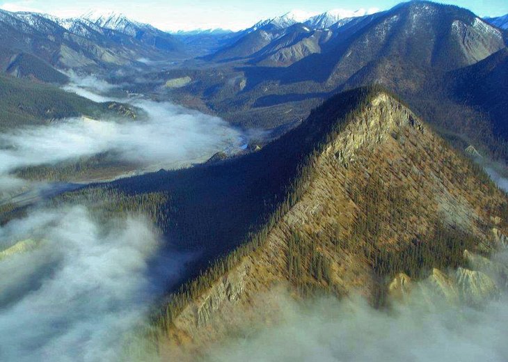

Nahanni National Park Reserve
Nahanni National Park Reserve | Fort Simpson Chamber of... / photo modified


The remote Nahanni National Park Reserve is one of the treasures of northern Canada and one of the best places to visit in the Northwest Territories for outdoor adventurers. Here, the raging Nahanni River flows through the stunning canyon scenery of the Mackenzie Mountains, challenging experienced canoeists and rafters. The South Nahanni River also tumbles over the 90-meter precipice of spectacular Virginia Falls, creating one of the most impressive waterfalls in Canada.

The Rabbitkettle Hot Springs, which give life to a rich landscape of rare plants, are another sightseeing attraction in this immense national park. As tempting as it would be to take a dip in the hot springs, the fragile nature of this beautiful natural attraction means tourists can only visit as part of a guided tour.

Accommodation: Where to Stay in the Northwest Territories

2. Wood Buffalo National Park
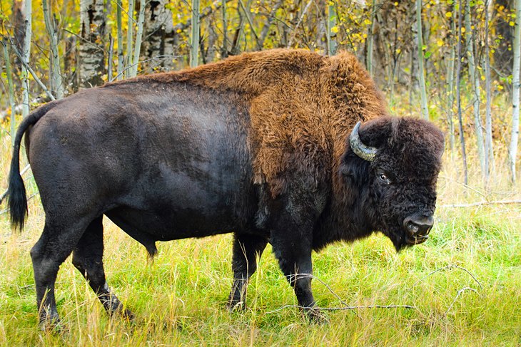

Wood buffalo
Wood buffalo


Wood Buffalo National Park is the biggest national park in Canada, and the second largest on the planet. This UNESCO World Heritage Site encompasses vast tracts of land in both Alberta and the Northwest Territories.

While the park was originally intended to protect the herds of wood buffalo that inhabit the area, it has also served as a safe haven for other important species, such as the extremely rare whooping cranes that nest in the delta region. Once a fur-trading post, Fort Smith is now the launching point for exploring the park, and bison are often spotted from the highway near town.

3. Yellowknife
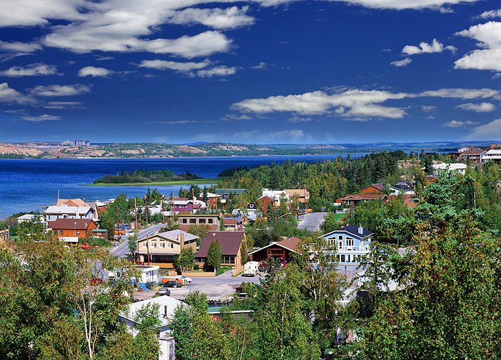

Yellowknife
Yellowknife


Yellowknife, capital of the Northwest Territories, grew up around a 1930s gold rush. While all of the miners tents of Old Town have long since been replaced, there is now a mix of wooden heritage buildings, arts and cultural institutions like the Prince of Wales Northern Heritage Centre, and a bustling community life fueled by the mining industry.

Popular things to do are the boat tours and houseboating on Great Slave Lake. Other activities and attractions are the impressive falls at Hidden Lake Territorial Park, visiting galleries featuring local artists, and seeing the Bush Pilots Monument.

If you find yourself here in the winter, the stunning Aurora Borealis viewing that can be enjoyed here is second to none. The Snow King Festival and its huge snow castle is also something not to be missed. Don't be afraid to join in the fun, as the town lets loose in March.

Accommodation: Where to Stay in Yellowknife

4. Great Slave Lake


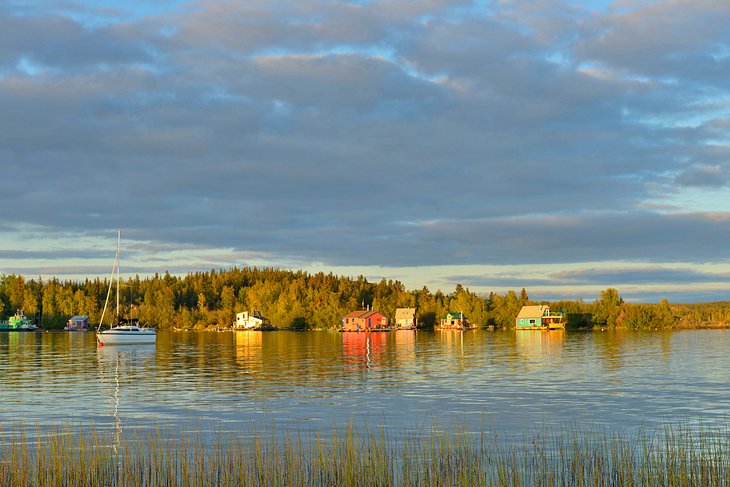
Great Slave Lake
Great Slave Lake


Great Slave Lake is North America's fifth largest lake and reaches depths of more than 600 meters in places. Though it's frozen for eight months of the year, it sees plenty of action. In summer, house boaters and sailors enjoy the freshwater. In fact, the lake is home to the Commissioner's Cup, the world's longest freshwater sailing race.

If you love to fish, don't miss the opportunity to head out onto the water and test your skills against one of the legendary giant trout, (some up to 40 pounds) lurking deep below. Bring your own boat and take your chances or take a charter and ensure success.

Come winter, dog sledders race on the frozen surface. Many of the major communities in the Northwest Territories front the lake, including YellowknifeFort Providence, and Hay River.

5. Hay River


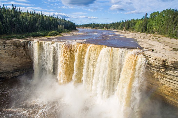
Alexandra Falls in Twin Falls Gorge Territorial Park near Hay River


On the southern bank of Great Slave Lake, Hay River is the southernmost port on the Mackenzie River System. Here, freight (mainly building materials and fuel) destined for settlements along the Mackenzie River and in the Arctic is transferred to barges. During the four- to five-month summer season, the port is chock-a-block with barges, fishing boats, and coast guard launches.

Long a home to First Nations people, Hay River became the first Hudson's Bay Company trading post in the area in 1868. The little wooden houses of the old town lie at the mouth of the Hay River. This is also where the fishermen live, often returning home with rich catches from Great Slave Lake, or the Hay and Mackenzie rivers.

In the newer area of town, Diamond Jenness School is an outstanding example of northern architecture. Named after an anthropologist who, around 1910, was the first to study northern native culture, the school boasts a purple color that makes it the landmark of Hay River. Southwest of town, Twin Falls Gorge Territorial Park features Hay River canyon and the Alexandra and Louise Falls, with trails and a viewing area.

6. Inuvik
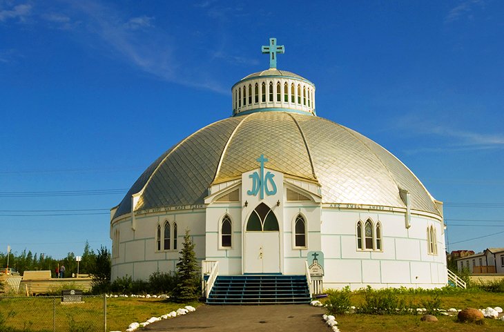

Famous igloo-shaped church


"Place of Man" is the Inuit meaning of Inuvik, a modern settlement in the Arctic Circle and on the Mackenzie River. Built between 1955 and 1961 during the exploration for oil and gas, it replaced Aklavik, which was prone to flooding.

Today, Inuvik is the trading, administrative, and supply center for the western Arctic. It has an airfield, several schools, and a hospital. From here, the many supply planes set off for the exploration bases in the far north to destinations such as the Mackenzie delta and Beaufort Sea. Sightseeing flights over the Arctic also take off from here.

Our Lady of Victory Roman Catholic Church, with its distinctive igloo shape, has become a landmark building of Inuvik. It contains a tabernacle (also igloo-shaped) and a remarkable "Way of the Cross" by Inuit artist Mona Thrasher. Aklavik, Inuit for "home of the polar bears" is west of Inuvik. The Hudson's Bay Company founded it in 1912 in the middle of the Mackenzie delta, an area prone to flooding. It is only accessible by a winter ice road.

Tuktut Nogait National Park, to the east of Inuvik was established in 1996, boasting some truly overwhelming arctic rock scenery with spectacular canyons and cliffs. Finds made at literally dozens of archaeological sites within the conservation area show that this now-inhospitable region was inhabited thousands of years ago. Access to the park is by air only, but well worth it if you can make it happen.

7. The Northwest Passage
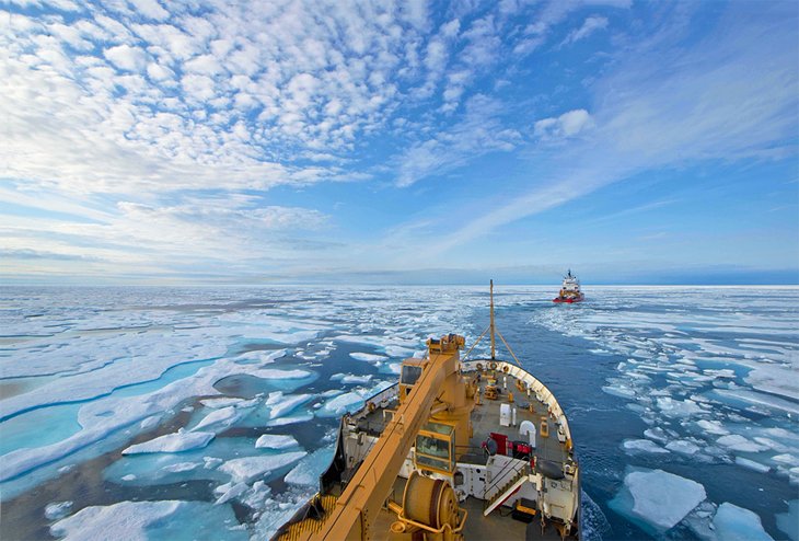

Icebreakers in the Franklin Straight, Northwest Passage


The Northwest Passage provides waterway access from the Atlantic Ocean through the Arctic to the Pacific Ocean. The search for the Northwest Passage began in the 16th century by Dutch and English navigators who hoped to find a favorable sea route for trade with the Far East and thus circumvent the Portuguese monopoly on trade round the Horn of Africa.

Martin Frobisher made the first attempt in 1576. He assumed that since saltwater never froze, this could not be the legendary sea of ice but just a frozen lake. In 1585-87 John Davis penetrated through the strait (later to bear his name) as far as Baffin Bay. Henry Hudson was looking for the Northwest Passage when he discovered Hudson Bay in 1609/1610. In 1616, William Baffin got as far as Lancaster Sound, but since he concluded that the Northwest Passage simply did not exist, there was no more exploration for another 200 years.

It was 1818 before John Ross resumed the search at the head of an English expedition, although the motive this time was scientific rather than commercial. In 1829, he discovered the magnetic north pole on the Boothia-Felix Peninsula.

The doomed expedition of John Franklin followed in 1845. After last being seen in July of that year in the Lancaster Sound, the members of the expedition were finally found dead on King Williams Island. They had succeeded in exploring much of the Arctic coast of North America.

McClure was the first, in 1850 to 1853, to be able to trace the passage on foot, coming over the iced up straits from the west. But the first person to finally manage to navigate the Northwest Passage from east to west was actually Roald Amundsen, the Norwegian polar explorer in 1900-03.

8. Great Bear Lake
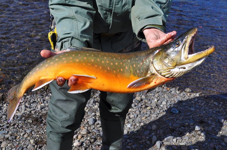

A large Arctic char
A large Arctic char


The eighth largest lake in the world, Great Bear Lake is 240 kilometers long and 400 kilometers across. It is covered with ice for eight months of the year, often as late as July. Its Great Bear River flows into the Mackenzie River. The shores of Great Bear Lake are rich in wildlife, with martens being particularly numerous. Grizzly bears roam the shores in summer, and the pinewoods are the haunt of elk in winter.

Great Bear Lake has achieved more angling records than any other lake in North America. It is especially famous for its trout, and some of the world's biggest (weighing up to 65 pounds) have been caught here, as well as top-weight grayling and whitefish. Arctic char can be found in the nearby Tree River. For a fishing tour of Great Bear Lake, hire a guide in Fort Franklin, now known as Deline.

9. Mackenzie River
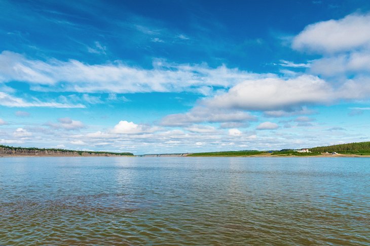

The Mackenzie River in the Northwest Territories


With a length of 4,250 kilometers, the Mackenzie River is the second longest river in North America, and its catchment area covers a fifth of Canada. The river was already an important artery for the canoes of the fur trade in the 18th century, and is navigable today in summer by steamers as far upriver as Fort Smith.

The Mackenzie Highway was built shortly after the Second World War and is an all-weather road covering the 600 kilometers from Peace River in Alberta to Great Slave Lake and the territorial capital Yellowknife.

Fort Simpson is situated where the Liard runs into the Mackenzie River, west of Great Slave Lake. It is the oldest settlement on the Mackenzie River, founded by the North West Company in 1804 for the trans-shipment of skins and furs at this strategic junction. In the 19th century, trade came from the few trappers and fishermen who lived here from time to time, but in the first half of the 20th century the forests in the Mackenzie Valley attracted the attention of the paper industry.

This was followed by the discovery of oil at Norman Wells in the 1920s, pitchblende at Port Radium, and gold at Yellowknife in the 1930s, with mining becoming a thriving industry after the Second World War. It is possible to catch planes from Fort Simpson to Nahanni National Park Reserve.

The vegetation of this delta landscape is mostly low bushes and shrubs, juniper, lichens, and mosses, with magnificent displays of color from flowers and mosses during the brief but intensive summer (from June to late July this is the land of the midnight sun). To complete the picture, this very special environment also has a great variety of wildlife on water as well as on land.

10. Victoria Island
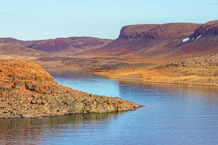

The west side of Victoria Island on the Amundsen Gulf


Situated directly off the northern coast of mainland Canada, Victoria Island is the third largest island in the Canadian Archipelago. It lies well north of the Arctic Circle, where Ice-Age glaciers flattened everything into a rather monotonous terrain of moraines, drumlins, and glacial lakes. The creation of the new Territory of Nunavut in 1999 divided the island administratively into two.

Canada's central Arctic region is administered and supplied from Iqaluktuutiak (Cambridge Bay) on the island's southeast coast. Sir John Franklin (1786-1847) "discovered" Victoria Island in 1826, and European seafarers searching for the Northwest Passage, missionaries, and fur traders were among the earliest to call in at this remote spot. Until the 1950s, the Copper Inuit used the area mainly as a summer camp; "Iqaluktuutiak," as it was called in Inuktitut, meaning "good place to fish."
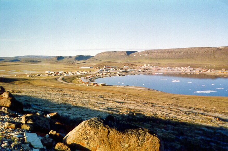

Victoria Island
Victoria Island | Alan Sim / photo modified


Iqaluktuutiak's main modern features are its stone-built Catholic church and modern wind-generation plant. The second place of any significance on Victoria Island is Ulukhaktok (formerly Holman) on the west coast. Located at the tip of the Diamond Jenness Peninsula, this small community is already quite well prepared for the burgeoning numbers of tourists attracted to the North. There is even a golf course with views of the Beaufort Sea.

11. Banks Island
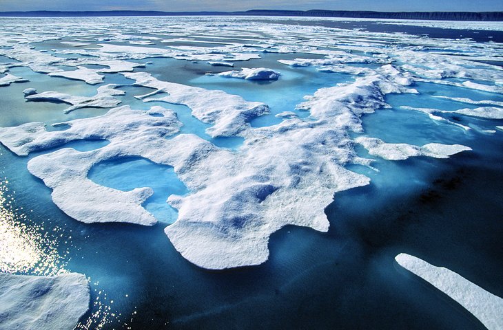

Banks Island
Banks Island


Banks Island possesses rich tundra vegetation and is home to many animals, especially the more than 65,000 musk-oxen (Ovibus moschatus), the largest population anywhere in the world. The southwestern part of Banks Island, equal to about one-third of the whole land mass, is a bird sanctuary.

Although it had been used for hunting for perhaps 3,500 years, it was not until 1929 that Banks Island had a permanent settlement, when three Inuit families put down roots in Ikaahuk (Sachs Harbor) on the northwestern tip of the island. Its "European" name derives from the Canadian Arctic expedition of 1913-15 led by Vilhjalmur Stefansson, whose ship was called Mary Sachs.

Situated in the north of Banks Island, Aulavik National Park is home to numerous musk-oxen. During the summer months, it is also home to a large proportion of Canada's snow geese. A completely intact tundra flora is still to be found here. This extremely remote park attracts adventurers looking to hike, backpack, or paddle the Thomsen River.

There are no services in Aulavik National Park, so visitors are expected to be experienced in the outdoors and self-sufficient. Visitors get to the park by chartering aircraft, usually from Inuvik.

12. Church of Our Lady of Good Hope, Fort Good Hope
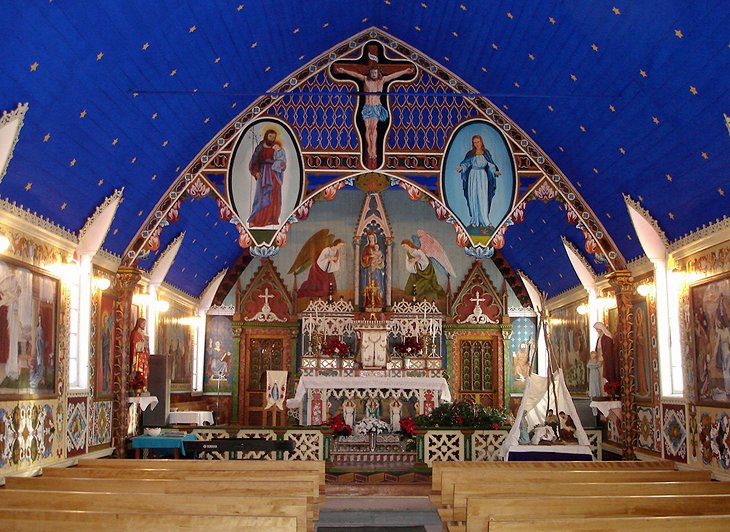

Church of Our Lady of Good Hope, Fort Good Hope
Church of Our Lady of Good Hope, Fort Good Hope | mattcatpurple / photo modified


The Church of Our Lady of Good Hope in Fort Hope is a national historic site that was built in the mid 1880s. It is one of the oldest surviving buildings of this type with much of the spectacular interior decoration designed and carried out by Father Émile Petitot. The mission church was built in the Gothic Revival Style.

Around the left side of the church is a historical graveyard with interesting headstones, some dating from the turn of the century.
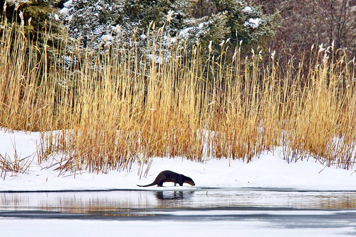
13. Norman Wells Historical Centre, Norman Wells

Report

Replies, comments and Discussions:

  • 枫下沙龙 / 游山玩水 / 请问去班芙和Jasper国家公园,是从多伦多飞Edmonton 还是Calgary 呢?还是飞Edmonton 然后Calgary 飞回多伦多?谢谢。
    • 这就像问去大瀑布飞多伦多还是渥太华一样,Google map +3
    • Calgary 往返,Calgary开到banff 只要1个半小时。 Edmonton开到Jasper要将近4个小时。banff 到Jasper 冰原大道适合往返来回开,景色很美,从Jasper返回banff是面向雪山开,更美,沿途景点一天玩不完的。 +3
    • 怎么走的人都有,我是先飞Edmonton, 因为Calgary 租不到车,如果能搞定车当然Calgary 往返, Edmonton 也没啥可看的 +1

      刚才查了一下, Edmonton 机场也租不到车了
      • Edmonton 北边 1000 来公里有个 Wood Buffalo National Park, 公园跨亚省和西北疆域
        • 我去过。一进公园就遇到一大群野牛。不过后面两天就没再看见了。公园旁边还有一家中餐馆。
          • 厉害,附近还有西北疆域的旅游景点,Great Slave Lake,Hay River,
            • 对,去了黄刀,在大奴隶湖游过泳。
              • 会旅游, 开过去黄刀, 500 多公里
            • 请问wood buffalo NP和 Hay river有啥好玩的?想从Edmonton开过去看极光
              • 13 Top-Rated Tourist Attractions in the Northwest Territories

                1. Nahanni National Park Reserve


                Nahanni National Park Reserve
                Nahanni National Park Reserve | Fort Simpson Chamber of... / photo modified


                The remote Nahanni National Park Reserve is one of the treasures of northern Canada and one of the best places to visit in the Northwest Territories for outdoor adventurers. Here, the raging Nahanni River flows through the stunning canyon scenery of the Mackenzie Mountains, challenging experienced canoeists and rafters. The South Nahanni River also tumbles over the 90-meter precipice of spectacular Virginia Falls, creating one of the most impressive waterfalls in Canada.

                The Rabbitkettle Hot Springs, which give life to a rich landscape of rare plants, are another sightseeing attraction in this immense national park. As tempting as it would be to take a dip in the hot springs, the fragile nature of this beautiful natural attraction means tourists can only visit as part of a guided tour.

                Accommodation: Where to Stay in the Northwest Territories

                2. Wood Buffalo National Park


                Wood buffalo
                Wood buffalo


                Wood Buffalo National Park is the biggest national park in Canada, and the second largest on the planet. This UNESCO World Heritage Site encompasses vast tracts of land in both Alberta and the Northwest Territories.

                While the park was originally intended to protect the herds of wood buffalo that inhabit the area, it has also served as a safe haven for other important species, such as the extremely rare whooping cranes that nest in the delta region. Once a fur-trading post, Fort Smith is now the launching point for exploring the park, and bison are often spotted from the highway near town.

                3. Yellowknife


                Yellowknife
                Yellowknife


                Yellowknife, capital of the Northwest Territories, grew up around a 1930s gold rush. While all of the miners tents of Old Town have long since been replaced, there is now a mix of wooden heritage buildings, arts and cultural institutions like the Prince of Wales Northern Heritage Centre, and a bustling community life fueled by the mining industry.

                Popular things to do are the boat tours and houseboating on Great Slave Lake. Other activities and attractions are the impressive falls at Hidden Lake Territorial Park, visiting galleries featuring local artists, and seeing the Bush Pilots Monument.

                If you find yourself here in the winter, the stunning Aurora Borealis viewing that can be enjoyed here is second to none. The Snow King Festival and its huge snow castle is also something not to be missed. Don't be afraid to join in the fun, as the town lets loose in March.

                Accommodation: Where to Stay in Yellowknife

                4. Great Slave Lake


                Great Slave Lake
                Great Slave Lake


                Great Slave Lake is North America's fifth largest lake and reaches depths of more than 600 meters in places. Though it's frozen for eight months of the year, it sees plenty of action. In summer, house boaters and sailors enjoy the freshwater. In fact, the lake is home to the Commissioner's Cup, the world's longest freshwater sailing race.

                If you love to fish, don't miss the opportunity to head out onto the water and test your skills against one of the legendary giant trout, (some up to 40 pounds) lurking deep below. Bring your own boat and take your chances or take a charter and ensure success.

                Come winter, dog sledders race on the frozen surface. Many of the major communities in the Northwest Territories front the lake, including YellowknifeFort Providence, and Hay River.

                5. Hay River


                Alexandra Falls in Twin Falls Gorge Territorial Park near Hay River
                Alexandra Falls in Twin Falls Gorge Territorial Park near Hay River


                On the southern bank of Great Slave Lake, Hay River is the southernmost port on the Mackenzie River System. Here, freight (mainly building materials and fuel) destined for settlements along the Mackenzie River and in the Arctic is transferred to barges. During the four- to five-month summer season, the port is chock-a-block with barges, fishing boats, and coast guard launches.

                Long a home to First Nations people, Hay River became the first Hudson's Bay Company trading post in the area in 1868. The little wooden houses of the old town lie at the mouth of the Hay River. This is also where the fishermen live, often returning home with rich catches from Great Slave Lake, or the Hay and Mackenzie rivers.

                In the newer area of town, Diamond Jenness School is an outstanding example of northern architecture. Named after an anthropologist who, around 1910, was the first to study northern native culture, the school boasts a purple color that makes it the landmark of Hay River. Southwest of town, Twin Falls Gorge Territorial Park features Hay River canyon and the Alexandra and Louise Falls, with trails and a viewing area.

                6. Inuvik


                Famous igloo-shaped church
                Famous igloo-shaped church


                "Place of Man" is the Inuit meaning of Inuvik, a modern settlement in the Arctic Circle and on the Mackenzie River. Built between 1955 and 1961 during the exploration for oil and gas, it replaced Aklavik, which was prone to flooding.

                Today, Inuvik is the trading, administrative, and supply center for the western Arctic. It has an airfield, several schools, and a hospital. From here, the many supply planes set off for the exploration bases in the far north to destinations such as the Mackenzie delta and Beaufort Sea. Sightseeing flights over the Arctic also take off from here.

                Our Lady of Victory Roman Catholic Church, with its distinctive igloo shape, has become a landmark building of Inuvik. It contains a tabernacle (also igloo-shaped) and a remarkable "Way of the Cross" by Inuit artist Mona Thrasher. Aklavik, Inuit for "home of the polar bears" is west of Inuvik. The Hudson's Bay Company founded it in 1912 in the middle of the Mackenzie delta, an area prone to flooding. It is only accessible by a winter ice road.

                Tuktut Nogait National Park, to the east of Inuvik was established in 1996, boasting some truly overwhelming arctic rock scenery with spectacular canyons and cliffs. Finds made at literally dozens of archaeological sites within the conservation area show that this now-inhospitable region was inhabited thousands of years ago. Access to the park is by air only, but well worth it if you can make it happen.

                7. The Northwest Passage


                Icebreakers in the Franklin Straight, Northwest Passage
                Icebreakers in the Franklin Straight, Northwest Passage


                The Northwest Passage provides waterway access from the Atlantic Ocean through the Arctic to the Pacific Ocean. The search for the Northwest Passage began in the 16th century by Dutch and English navigators who hoped to find a favorable sea route for trade with the Far East and thus circumvent the Portuguese monopoly on trade round the Horn of Africa.

                Martin Frobisher made the first attempt in 1576. He assumed that since saltwater never froze, this could not be the legendary sea of ice but just a frozen lake. In 1585-87 John Davis penetrated through the strait (later to bear his name) as far as Baffin Bay. Henry Hudson was looking for the Northwest Passage when he discovered Hudson Bay in 1609/1610. In 1616, William Baffin got as far as Lancaster Sound, but since he concluded that the Northwest Passage simply did not exist, there was no more exploration for another 200 years.

                It was 1818 before John Ross resumed the search at the head of an English expedition, although the motive this time was scientific rather than commercial. In 1829, he discovered the magnetic north pole on the Boothia-Felix Peninsula.

                The doomed expedition of John Franklin followed in 1845. After last being seen in July of that year in the Lancaster Sound, the members of the expedition were finally found dead on King Williams Island. They had succeeded in exploring much of the Arctic coast of North America.

                McClure was the first, in 1850 to 1853, to be able to trace the passage on foot, coming over the iced up straits from the west. But the first person to finally manage to navigate the Northwest Passage from east to west was actually Roald Amundsen, the Norwegian polar explorer in 1900-03.

                8. Great Bear Lake


                A large Arctic char
                A large Arctic char


                The eighth largest lake in the world, Great Bear Lake is 240 kilometers long and 400 kilometers across. It is covered with ice for eight months of the year, often as late as July. Its Great Bear River flows into the Mackenzie River. The shores of Great Bear Lake are rich in wildlife, with martens being particularly numerous. Grizzly bears roam the shores in summer, and the pinewoods are the haunt of elk in winter.

                Great Bear Lake has achieved more angling records than any other lake in North America. It is especially famous for its trout, and some of the world's biggest (weighing up to 65 pounds) have been caught here, as well as top-weight grayling and whitefish. Arctic char can be found in the nearby Tree River. For a fishing tour of Great Bear Lake, hire a guide in Fort Franklin, now known as Deline.

                9. Mackenzie River


                The Mackenzie River in the Northwest Territories
                The Mackenzie River in the Northwest Territories


                With a length of 4,250 kilometers, the Mackenzie River is the second longest river in North America, and its catchment area covers a fifth of Canada. The river was already an important artery for the canoes of the fur trade in the 18th century, and is navigable today in summer by steamers as far upriver as Fort Smith.

                The Mackenzie Highway was built shortly after the Second World War and is an all-weather road covering the 600 kilometers from Peace River in Alberta to Great Slave Lake and the territorial capital Yellowknife.

                Fort Simpson is situated where the Liard runs into the Mackenzie River, west of Great Slave Lake. It is the oldest settlement on the Mackenzie River, founded by the North West Company in 1804 for the trans-shipment of skins and furs at this strategic junction. In the 19th century, trade came from the few trappers and fishermen who lived here from time to time, but in the first half of the 20th century the forests in the Mackenzie Valley attracted the attention of the paper industry.

                This was followed by the discovery of oil at Norman Wells in the 1920s, pitchblende at Port Radium, and gold at Yellowknife in the 1930s, with mining becoming a thriving industry after the Second World War. It is possible to catch planes from Fort Simpson to Nahanni National Park Reserve.

                The vegetation of this delta landscape is mostly low bushes and shrubs, juniper, lichens, and mosses, with magnificent displays of color from flowers and mosses during the brief but intensive summer (from June to late July this is the land of the midnight sun). To complete the picture, this very special environment also has a great variety of wildlife on water as well as on land.

                10. Victoria Island


                The west side of Victoria Island on the Amundsen Gulf
                The west side of Victoria Island on the Amundsen Gulf


                Situated directly off the northern coast of mainland Canada, Victoria Island is the third largest island in the Canadian Archipelago. It lies well north of the Arctic Circle, where Ice-Age glaciers flattened everything into a rather monotonous terrain of moraines, drumlins, and glacial lakes. The creation of the new Territory of Nunavut in 1999 divided the island administratively into two.

                Canada's central Arctic region is administered and supplied from Iqaluktuutiak (Cambridge Bay) on the island's southeast coast. Sir John Franklin (1786-1847) "discovered" Victoria Island in 1826, and European seafarers searching for the Northwest Passage, missionaries, and fur traders were among the earliest to call in at this remote spot. Until the 1950s, the Copper Inuit used the area mainly as a summer camp; "Iqaluktuutiak," as it was called in Inuktitut, meaning "good place to fish."


                Victoria Island
                Victoria Island | Alan Sim / photo modified


                Iqaluktuutiak's main modern features are its stone-built Catholic church and modern wind-generation plant. The second place of any significance on Victoria Island is Ulukhaktok (formerly Holman) on the west coast. Located at the tip of the Diamond Jenness Peninsula, this small community is already quite well prepared for the burgeoning numbers of tourists attracted to the North. There is even a golf course with views of the Beaufort Sea.

                11. Banks Island


                Banks Island
                Banks Island


                Banks Island possesses rich tundra vegetation and is home to many animals, especially the more than 65,000 musk-oxen (Ovibus moschatus), the largest population anywhere in the world. The southwestern part of Banks Island, equal to about one-third of the whole land mass, is a bird sanctuary.

                Although it had been used for hunting for perhaps 3,500 years, it was not until 1929 that Banks Island had a permanent settlement, when three Inuit families put down roots in Ikaahuk (Sachs Harbor) on the northwestern tip of the island. Its "European" name derives from the Canadian Arctic expedition of 1913-15 led by Vilhjalmur Stefansson, whose ship was called Mary Sachs.

                Situated in the north of Banks Island, Aulavik National Park is home to numerous musk-oxen. During the summer months, it is also home to a large proportion of Canada's snow geese. A completely intact tundra flora is still to be found here. This extremely remote park attracts adventurers looking to hike, backpack, or paddle the Thomsen River.

                There are no services in Aulavik National Park, so visitors are expected to be experienced in the outdoors and self-sufficient. Visitors get to the park by chartering aircraft, usually from Inuvik.

                12. Church of Our Lady of Good Hope, Fort Good Hope


                Church of Our Lady of Good Hope, Fort Good Hope
                Church of Our Lady of Good Hope, Fort Good Hope | mattcatpurple / photo modified


                The Church of Our Lady of Good Hope in Fort Hope is a national historic site that was built in the mid 1880s. It is one of the oldest surviving buildings of this type with much of the spectacular interior decoration designed and carried out by Father Émile Petitot. The mission church was built in the Gothic Revival Style.

                Around the left side of the church is a historical graveyard with interesting headstones, some dating from the turn of the century.
                13. Norman Wells Historical Centre, Norman Wells

                • 谢谢,看起来这个NP就是个动物保护区,没有太多开发的人类活动的机会。Hay river有个瀑布
                  • 不客气, 如果开车去加拿大北冰洋, 还要经过BC省, 育空
        • 再死点劲儿直接到北极了
          • 附近还有其它西北疆域的旅游景点,Great Bear Lake, Norman Wells Historical Centre, Norman Wells, 北极附近还有 Inuvik

            加拿大唯一, 努纳威特 Nunavut 开车去不了
            • 只想去班夫,没打算去北极
              • 加拿大专门花了三个亿加币, 修了一百多公里永久公路, 直达北冰洋边
                • 有钱任性
                  • 之前, 要从Inuvik 坐飞机, 或者冬天开冰上的公路过去北冰洋边
      • 七月初多伦多飞Calgary, 班芙和Jasper国家公园,去Edmonton 回Calgary, 飞多伦多,小孩要Edmonton 打卡,Calgary还要看看牛仔节,去恐龙公园,定个车还不知道是啥
        • 你这么折腾还不如我的路线呢
          • 本来没计划,小孩要Edmonton 打卡, 就是看看那个世界最大的mall
        • Calgary有什么好玩的地方?夏天要去一个星期。
          • Calgary本身没啥的
            • 看看这个,貌似活动挺多的
              • 这貌似各种活动。
            • 预留了三天空闲时间,估计不够在Banff玩的。不知道到时候在Calgary能不能租到车。
              • 打卡也成呀,不在机场租车估计还可以,租车住宿都很贵,不要以常理估算
                • 等在Calgary住下,我打探一下。估计就蜻蜓点水走马观花走一圈。
                • 现在租车太难了
                  • 确实是,贵不说,关键租不到,看Edmonton 咋样
    • 什么时候去啊?7,8月酒店价格很贵
      • 7,8月去, 不要住班夫, 住附近 Canmore, 没有那么贵
        • Canmore其实没便宜多少,还miss掉Banff小镇晚上的活动,还是尽量住Banff比较好 +1
          • 或许
        • 我每次去都住一个叫Field的小镇,除了离Banff镇远一点外,离路易斯湖,梦莲湖,翡翠湖,沛托湖等众多景点都近,价格比住Banff,Canmore便宜多了。
          • 谢谢,我听说过Canmore 更靠近班芙的地方·,你这个更好
            • 如果要在Banff玩几天的话,只住Canmore每天往返就要花不少时间。
              • 班夫主要玩八个湖, 几天
    • 我们二月订了机票,酒店和车,一大帮人6月下旬飞Calgary,Banff附近7天,再南下边境冰川国家公园4天,Calgary飞回多伦多。租车可以考虑机场周边的,价钱便宜至少1/3。热门季节去热门地方,我们都尽量及早安排,而且尽量避开高峰,长周末之前我们已离开Banff地区。 +1
      • 俺赶上长周末,周边租车公司不开门
      • 6月底学校才放假,孩子小可以旷那么多天的课,孩子大了就不行了
    • Just 35 minutes east of Edmonton: "Elk Island National Park", entrance fee included in The Discovery Pass. +1
      • 亚省旅游景点,再往东还有莎省其它旅游景点,12 Top-Rated Tourist Attractions in Saskatchewan,

        1. Prince Albert National Park


        Prince Albert National Park
        Prince Albert National Park


        Prince Albert National Park is a gently undulating landscape of spruce bogs, large lakes, and aspen-dotted uplands. It's a hot spot for wildlife watching. The park's northern forests have Canada's second largest colony of white pelicans at Lavallée Lake, a roaming herd of Sturgeon River plains bison, plus moose, wolves, black bears, fox, lynx, caribou, and eagles. In the southern parklands, you'll find elk, deer, badgers, coyotes, and squirrels.

        The park also has one of the best beaches in Saskatchewan: Waskesiu Main Beach. This 600-meter stretch of golden sand is located on the eastern end of Waskesiu Lake and is backed by green lawns and trees. Just across the street from the beach are restaurants and local shops that make grabbing an ice cream on a hot, sunny day an easy task.

        If this beach isn't to your liking, nine others are sprinkled around the lake, many of which are quiet and deserted. It can get windy here, so take a look at the wind direction, and select your beach appropriately.

        First Nations people have lived here for thousands of years, and there is archaeological evidence that in severe winters, tribes from the prairies moved north to these sheltered woodlands, intermingling with the people who lived here.

        Grey Owl, a colorful and controversial naturalist of the 1930s, lived in this park for seven years in a small log cabin called "Beaver Lodge" on Ajawaan Lake. The author's popular books tell of his love for the wilderness, threatened by the advance of civilization. His cabin can be reached by boat or canoe across Kingsmere Lake, or by a 20-kilometer trail from the south end of the lake.

        Official site: www.pc.gc.ca/pn-np/sk/princealbert/index.aspx

        2. Saskatoon


        Ukrainian Church
        Ukrainian Church


        Sunny Saskatoon is a pleasant city in the South Saskatchewan River. Many tourist attractions explore the local heritage, from the first Prairies people at the Wanuskewin Heritage Park to European settlers and culture at the Ukrainian Museum of Canada. The largest of the province's four Western Development Museums is located in the city and features a vibrant reconstructed main street known as "Boomtown 1910."

        Traveling with kids? Then be sure to include the Saskatoon Forestry Farm Park & Zoo on your Saskatoon itinerary, popular not just for its creature collection but also its beautiful grounds. Interested in art? Pay a visit to the new Remai Modern Museum, already famous for its collection of works by Picasso.

        Accommodation: Where to Stay in Saskatoon

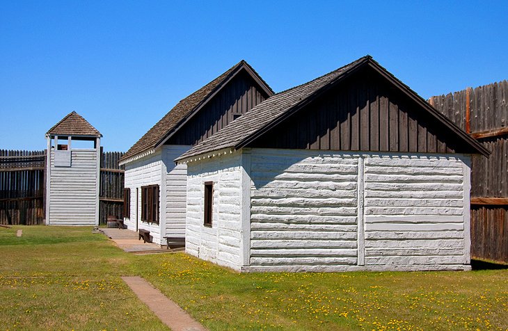
        3. Fort Walsh National Historic Site


        Fort Walsh National Historic Site
        Fort Walsh National Historic Site | daryl_mitchell / photo modified


        Fort Walsh National Historic Site was established in 1875 under the direction of James Walsh. It was intended to stop the illegal whisky trade and became one of the most important posts in the West. During its life, the fort negotiated with the whisky traders, the native peoples, and the thousands of Sioux warriors who sought refuge in Canada after clashes with the U.S. cavalry.

        Following the building of the railway and the return of the Sioux people to the USA, the fort was dismantled and abandoned. In 1942, the Royal Canadian Mounted Police acquired the land and built a ranch on which to breed horses. When the RCMP transferred to Ontario, the estate became a national historic site with a comprehensive reconstruction program. In addition to enjoying costumed re-enactments, fun things to do at Fort Walsh include hiking and biking along its extensive trail network.

        Address: Fort Walsh, Maple Creek, Saskatchewan

        Official site: www.pc.gc.ca/en/lhn-nhs/sk/walsh

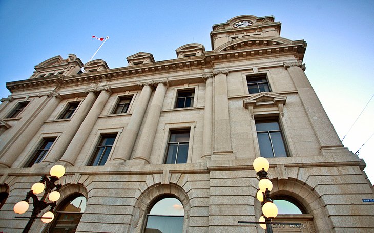
        4. Regina


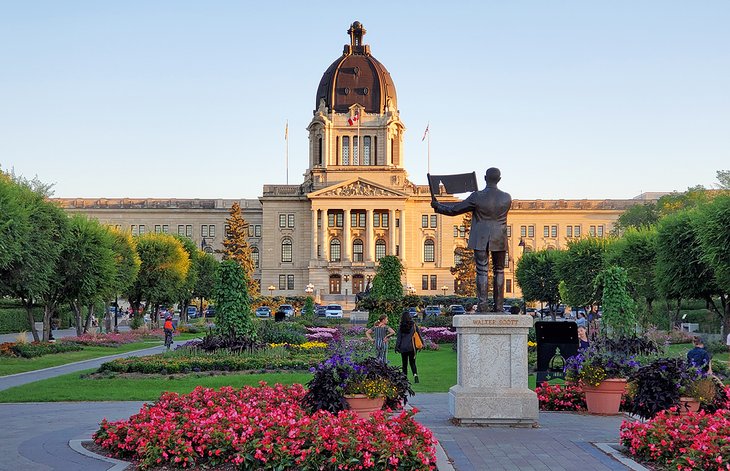
        Legislature Building in Region
        Legislature Building in Region | Photo Copyright: Lana Law


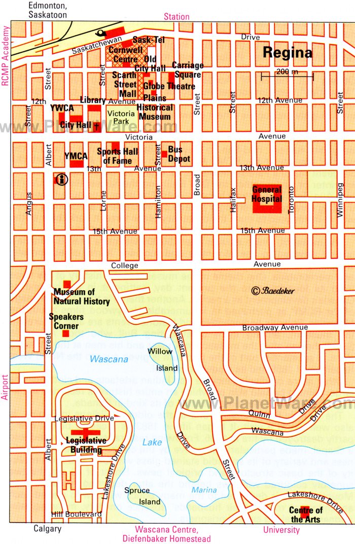
        A cosmopolitan commercial and cultural center, Regina is the setting for many government and provincial institutions, some of which, like the Saskatchewan Legislative Building, can be visited. It enjoys economic prosperity, and boasts a number of arts and heritage attractions, including the illuminating Royal Saskatchewan Museum and Mackenzie Art Gallery near the parklands of Wascana Centre around Wascana Lake.

        Parades and other military-tattoo-like events are a popular feature at the city's RCMP Heritage Centre, while exploring science is the order of the day at the Saskatchewan Science Centre.

        Read More: Top-Rated Attractions & Things to Do in Regina

        Accommodation: Where to Stay in Regina

        5. RCMP Heritage Centre


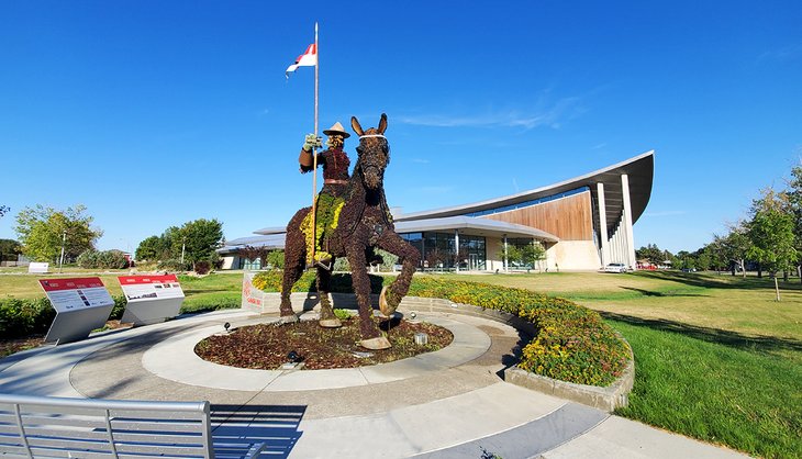
        RCMP Heritage Centre
        RCMP Heritage Centre | Photo Copyright: Lana Law


        The RCMP Heritage Centre is the largest of its kind in Canada, with displays of equipment, weapons, photographs, and more. Both the Sergeant Major's Parade (held in the Parade Square, alternately in the Drill Hall in winter or bad weather) and the Sunset Retreat (summer) attract large crowds. The latter is a colorful flag ceremony involving a parade of recruits and a marching band, harking back to the tattoos of 18th- and 19th-century British military tradition.

        Other fun things to do here include trying on related RCMP regalia, and joining an informative guided tour of the site.

        Address: 5907 Dewdney Avenue, Regina, Saskatchewan

        Official site: www.rcmpheritagecentre.com/


        Regina Map - Tourist Attractions
        Regina Map - Attractions (Historical)


        6. Batoche National Historic Site


        Batoche National Historic Site
        Batoche National Historic Site | danrmg / photo modified


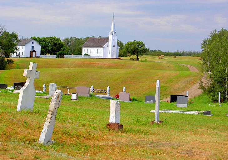
        Batoche was the headquarters of the famous Métis, Louis Riel, during the 1885 Northwest Rebellion. It is also where the rebellion finally came to an end, following a decisive battle. Displays illustrate the way of life of the Métis, events leading up to the rebellion, and the battle of May 1885.

        The presbytery, still showing shell and bullet-holes from the battle, and the Church of St. Antoine de Padoue (1883-84) are now excellent museums. The graves of Dumont and Letendre and a mass grave of fallen Métis can be found in the churchyard. There's a good shuttle bus service to get you around this sprawling site, and other fun things to do include renting a canoe and interacting with costumed guides.

        Official site: www.pc.gc.ca/en/lhn-nhs/sk/batoche

        7. Trans-Canada Highway through Saskatchewan


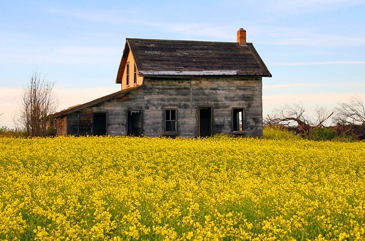
        Abandoned farmhouse along the Trans-Canada Highway
        Abandoned farmhouse along the Trans-Canada Highway


        By following the Trans-Canada Highway as it runs across the prairies and fields of southern Saskatchewan, visitors can see a substantial part of the province. In the summer, the fields become a riot of color, with canola blooming a brilliant yellow and flax blossoming in a vibrant purple. Near Chaplin, the colorful fields vanish and are replaced with shallow lakes and blindingly white piles of salt.

        When planning your route, it is best to start from the province's southeast border with Manitoba, and drive east-to-west along the Highway, which passes through the capital, Regina, Moose Jaw, and the town of Swift Current.

        Detours can then be made either north or south to many other interesting places to visit that are easily accessible from the highway, places like Moose Mountain Provincial ParkQu'Appelle Valley, and Cypress Hills Provincial Park. Plenty of opportunities for swimming, fishing, and hunting will be found along the way.

        Note that Saskatchewan is sadly lacking in highway rest stops. Plan your bathroom breaks to coincide with the larger centers mentioned above.

        8. Cypress Hills & Grasslands National Park


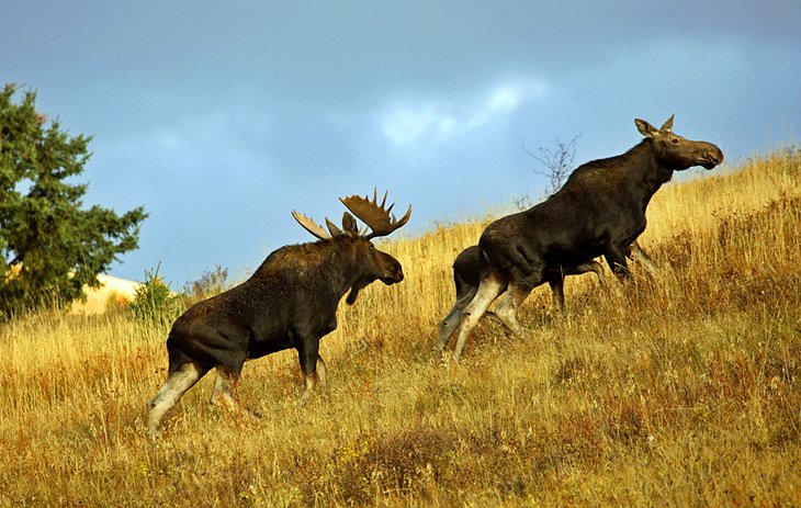
        Moose in Cypress Hills
        Moose in Cypress Hills


        The highest point in Saskatchewan is in Cypress Hills, a vast tract of land in the province's southwest. The region encompasses premier outdoor attractions, including an inter-provincial park that straddles the Alberta-Saskatchewan border and Grasslands National Park, near the U.S. border.

        The park is vast and offers a great opportunity to escape to nature. Take a hike and wander through the hills on your own, or pitch a tent in the campground. At night, build a crackling fire and gaze up at an unbelievably dark sky filled with a billion stars.

        Though prehistoric sites in the Drumheller area of Alberta are better known, Saskatchewan's Eastend is home to the T.rex Discovery Centre and its full-size skeleton replicas are well worth a visit.

        9. Fort Carlton Provincial Park


        Fort Carlton Provincial Park
        Fort Carlton Provincial Park


        Fort Carlton was originally established as an outpost of the Hudson's Bay Company in 1795 to provide river patrols and provisions for fur traders, and remained in use until 1885. Rebuilt on the foundations of the third and final site on which the fort stood, the present rendition, while a replica of the original (it was built in 1967), offers a fascinating look at life during this period.

        Take a canoe tour in summer, or wander the grounds to see the reconstructed fort, a Cree village, displays of hides, and various supplies.

        Address: 212 Hwy, Duck Lake, Saskatchewan

        10. Moose Jaw


        Moose Jaw
        Moose Jaw


        The "friendly city" of Moose Jaw sits at the meeting of the Moose Jaw River and Thunder Creek. The city's top attraction is The Tunnels of Moose Jaw, which remain from the days of the first Chinese immigrants. Today, costumed guides recreate characters from Moose Jaw history here. And then, of course, there's Mac the Moose, the giant moose sculpture that graces the grounds of the city's welcome center.

        Another branch of Saskatchewan's Western Development Museums is located in Moose Jaw, focusing on the history of Prairie transportation. Other notable museums can be enjoyed in Saskatoon, North Battleford, and Yorkton.

        Accommodation: Where to Stay in Moose Jaw

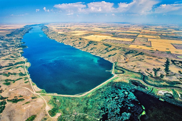
        11. Qu'Appelle Valley


        Aerial view of Buffalo Pound Provincial Park
        Aerial view of Buffalo Pound Provincial Park


        Extending along the Qu'Appelle River is a beautiful, steep-sided valley, carved out of the gently undulating prairie by glacial waters. It is a rich garden-style landscape, with eight lakes strung out along the valley creating unique ecosystems.

        The Qu'Appelle Valley is one of Saskatchewan's most popular summer destinations, with three amazing parks to visit. Buffalo Pound Provincial Park, located in the western region, has a great swimming area, mountain bike trails, and camping. Nearby Echo Valley Provincial Park near Fort Qu'Appelle has two beaches on two lakes along with a lovely walking trail and camping opportunities. A bit farther east, Crooked Lake Provincial Park has a great campground featuring amazing waterfront sites, hiking trails, and a golf course nearby.

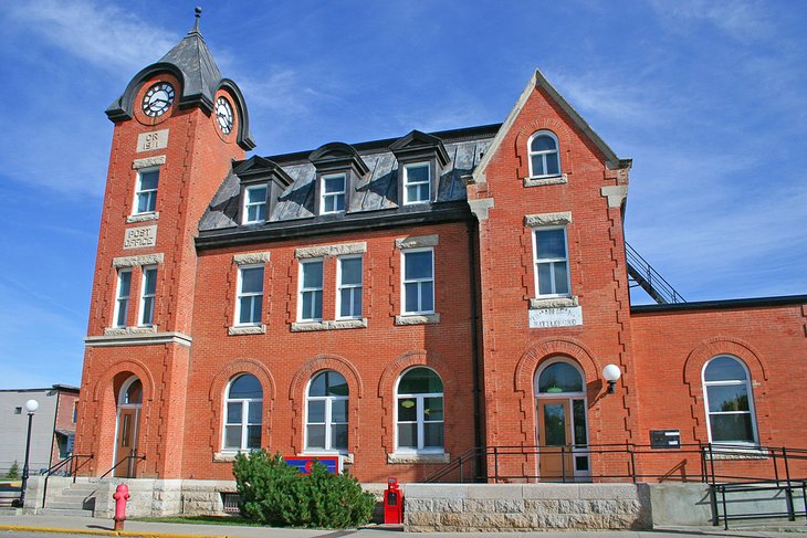
        12. The Battlefords


        The Post Office in Battleford, Saskatchewan
        The Post Office in Battleford, Saskatchewan


        The Battlefords consist of two cities, North Battleford and Battleford, that are across the Saskatchewan River from one another. During the early settlement days, Battleford was an important Mounted Police post and the first seat of Northwest Territories government. Fort Battleford National Historic Site explores the past of the Mounties with exhibits in refurbished buildings.

        The city's Western Development Museum puts agricultural history into practice with a farm and village. If you've got some time, consider a pleasant walk up to the top of King Hill for nice views out over the city and surrounding area.

    • 无关乎优劣, 主要看自己的兴趣。二种路线我都走过。
      • 赶紧请教一下,从Edmonton到Hinton之间有啥可看的?
        • nothing
          • 离 Jasper National Park Of Canada 已经很近了,